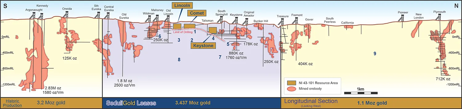
The Lincoln mine has a resource of 284K oz gold at an average grade of 9g/t in three orebodies, Lincoln, Comet, and Keystone, which are up to 150m below surface in the first two and up to 250m from surface in the latter. Seduli owns the minerals rights to a contiguous 3.4-mile (5.5-kilometer) section of the Mother Lode’s historically most productive 10-kilometer section, from which more than 7.7 million ounces of gold were mined up to the 1930s. The Jackson-Plymouth segment has produced 50% of total output, making it the most productive segment of the Mother Lode.
The mine currently consists of an 880m decline and approximately 890m of ore drives, as well as ventilation drives, rises, and a variety of crosscut stock piles spaced every 60m along the decline. The steeply dipping lodes in the Lincoln mine’s orebodies are ideal for long hole stopping with electro-hydraulic equipment. The Central Comet Lode is immediately accessible without requiring additional development.
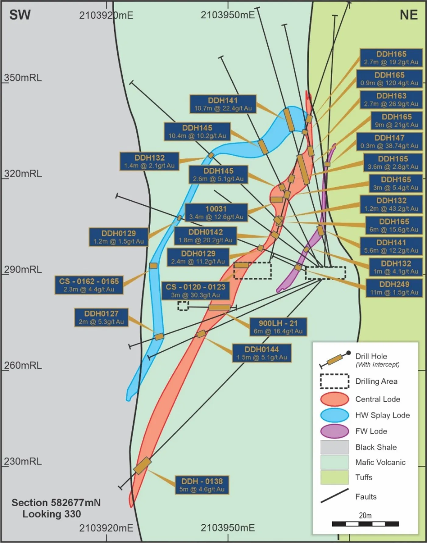
Section through Comet orebody.
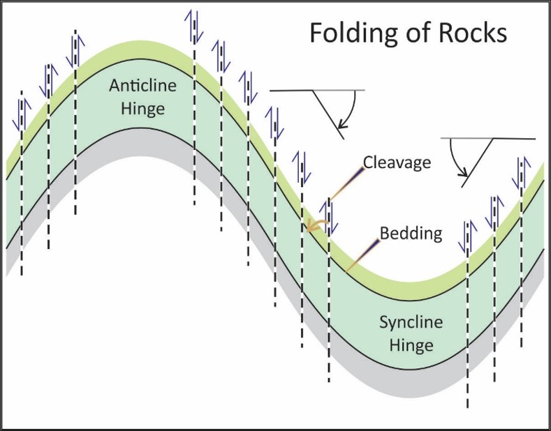
The orebodies are hosted by high strain zones that are shallower-dipping than stratigraphy, which gets younger to the east. This is of particular importance to understanding the structural geology of the deposit and future exploration. In the Language of structural geology, this relationship is called the cleavage-bedding vergence and it indicates the deposit is located on the east-dipping limb of an anticline located to the west.
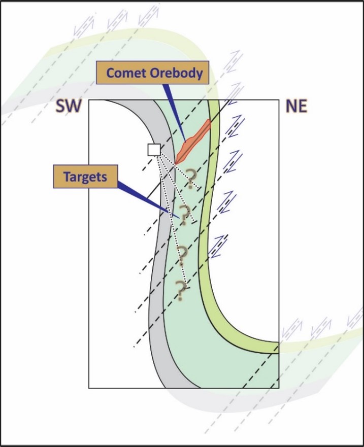
Schematic illustration structural setting of gold deposits at the Lincoln mine
An en echelon array of parallel high axial planar strain zones that were mineralised within the mafic volcanic rocks.
Lincoln and Comet Drilling to date:
- 850 m x 150 m panel & open along strike and down dip
- 249 Diamond Holes for 26,458m
- Average Drill Spacing – 23 m x 23 m
- 7,358 assays average length 0.94m (3 ft)
- Average of samples ≥ 2g/t Au = 10.05 g/t Au (969 samples)*
- Average of samples ≥ 4 g/t Au = 16.2 g/t Au (525 samples)*
Due to a lack of drilling outside of the current resource areas, the project has excellent potential to increase resources. Drilling will target repetitions of the Comet and Lincoln orebodies at depth.
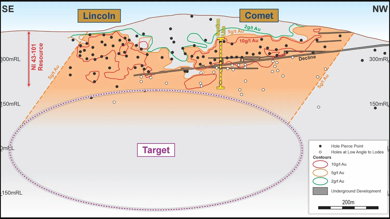
Longitudinal Section Looking Southwest. The Lincoln and Comet orebodies are distinct at the 10g/t au contours of block model. Drilling below the decline is at a low angle to the lodes. Deposit is open below drilling.
Exploration will initially focus on the volume below the Lincoln and Comet orebodies to a depth of about 1 km. Following that, historic resources at Keystone and Wildman-Mahoney will be drilled that were excluded from resource estimates beginning in 2008 because they were based on historical data. Furthermore, down-dip extensions of both of these orebodies will be tested. This drilling is expected to take 2-3 years before moving on to systematically drilling out these areas in order to collect data for resource estimation.
Our ore processing permit of 317,500 tonnes per annum allows for 100K oz gold production per year at the average grade of the belt to date, prior to the deployment of technology such as ore sorters to maximise the grade of ore fed to the mill.
Our goal is to construct a production unit capable of producing 100,000 oz of gold per year for at least several decades. We believe that the lack of drilling along the Mother Lode, combined with the level of historic production, means that defining the resources over the next 3-5 years is very likely.
Longitudinal section from Jackson in the south to Plymouth in the north, looking west.